If you’ve only mapped metro lines, you haven’t mapped the city
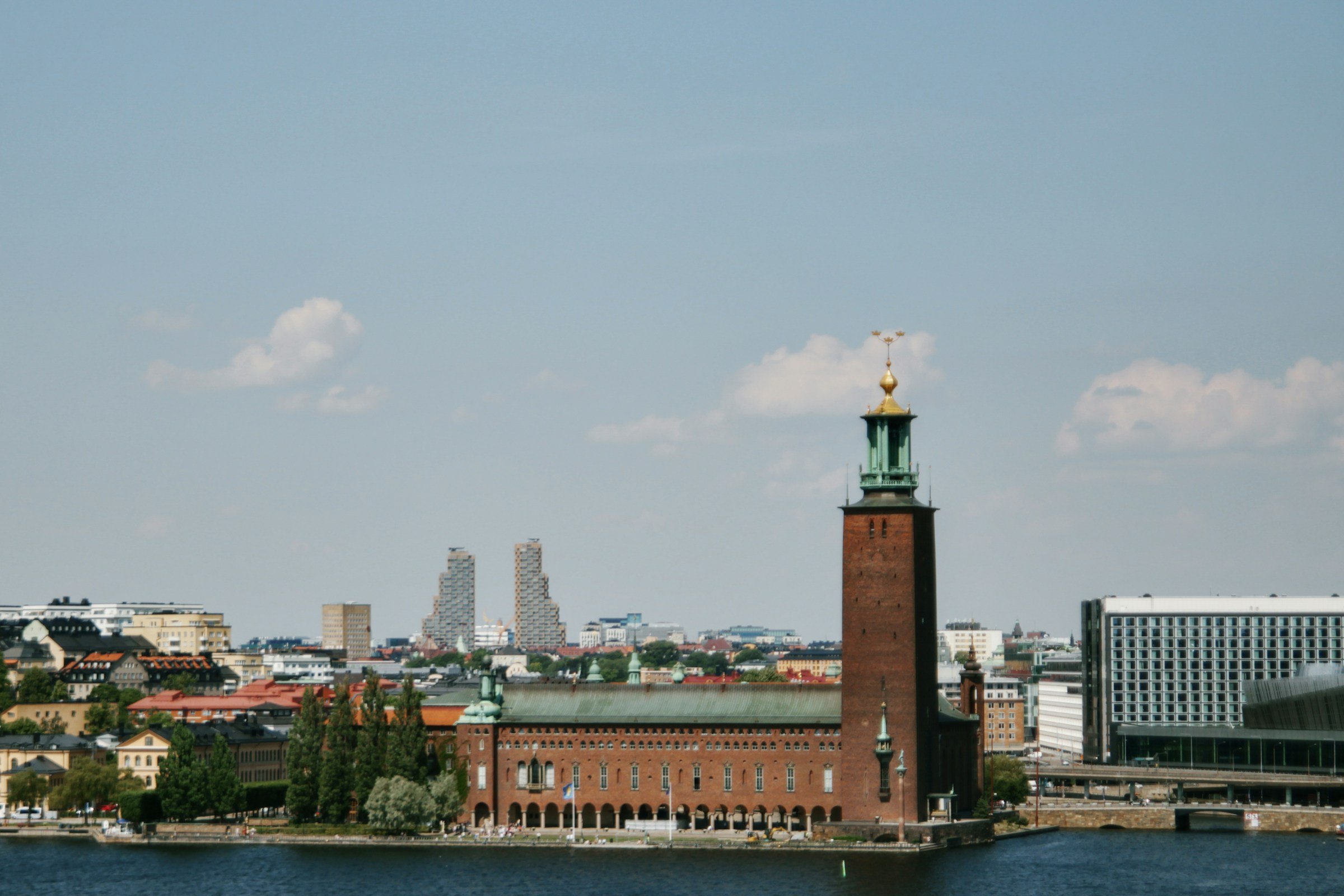
Stockholm’s subway riders think they know the geography. Three colored lines, fifty-plus stations, neat intersections at T-Centralen. The map suggests a city you navigate by tunnels. Then you exit at Slussen and realize the metro simply burrows under what makes Stockholm strange: you are standing on an island, Södermalm, looking across water at another island, Gamla Stan, with a third island, Kungsholmen, visible to the west. The train you just rode threaded through bedrock beneath channels that divide the city into fragments that refuse to merge into a single downtown.

Stockholm
Neighborhoods here don’t blur at their edges. They stop at water. Östermalm ends where Djurgården begins, separated by Djurgårdsbrunnsviken. Kungsholmen and Norrmalm meet only at bridges. You will cross water ten times in a day without planning to. The ferries, bridges, and tunnels are not romantic features. They are infrastructure responding to a city that cannot exist without constant crossings.
If you expect charming canal boats, prepare for public ferries that smell like diesel
The hop-on sightseeing boats circling Djurgården photograph well. Tourists lean over railings near the Vasa Museum while a recorded voice names islands in five languages. These boats cost 395 kronor (37 USD) and deliver you nowhere useful.
The ferry you need is line 80, part of the SL transit system. It runs from Nybroplan to Allmänna Gränd on Djurgården every twelve minutes. Same ticket as the bus. Same monthly pass. It crosses Nybroviken in four minutes, saving a twenty-minute walk around via Djurgårdsbron. No commentary, no tickets sold onboard, just commuters and tourists who figured out that Stockholm’s best views cost the price of a zone transfer.
Ferries 82 and 89 connect neighborhoods the metro ignores. Line 89 runs from Kungsholmen to Södermalm via Riddarholmen, cutting under bridges too low for tour boats. Line 82 threads through the southern archipelago to Fjäderholmarna. You board next to someone carrying groceries. The city treats water like other places treat a six-lane boulevard.
If you think islands mean small, Södermalm will correct you
Södermalm is an island larger than the entire historic center of Copenhagen. It holds four distinct neighborhoods, a hundred restaurants, the main hiking cliffs at Skinnarviksberget, and housing for 120,000 people. You can walk forty minutes from Hornstull to Skanstull and never leave Södermalm, never see the water that defines its borders.
The island logic means neighborhoods develop their own supply chains. Södermalm has three separate clusters of grocery stores, bakeries, and late-night kiosks. Residents of Hornstull rarely venture to Medborgarplatsen. Why would they? The distance is short but crossing back from Norrmalm after work tilts you toward staying on your own island.
This is why Stockholmers ask which island you are staying on, not which neighborhood. “Kungsholmen or Södermalm?” determines whether you are ten minutes or forty minutes from Fotografiska, whether your closest grocery is Hemköp on Hantverkargatan or ICA Kvantum on Folkungagatan. The metro collapses this psychologically but your feet remember every bridge.
If you plan to walk everywhere, the bridges will pace you

Stockholm
Eight bridges connect Gamla Stan to the surrounding islands. Most tourists use two: Riksbron to Norrmalm, Slussenbron to Södermalm. Learning the other six changes how fast you move.
Stallbron, on the western edge of Gamla Stan, delivers you to Riddarholmen and then across Riddarholmsbron to Kungsholmen with almost no foot traffic. Strömbron runs wider and flatter than Riksbron and spills you out near the Grand Hôtel instead of the Riksdag. Skeppsholmsbron takes you to Skeppsholmen island in three minutes, where the Moderna Museet sits empty most weekday mornings.
Each bridge has a pedestrian flow shaped by what it connects. Västerbron, linking Kungsholmen and Södermalm, carries runners and cyclists at dawn. Liljeholmsbron sees almost no tourists but steady local traffic between two residential islands. Bridges near T-Centralen clog after 17:00 when offices empty. Bridges to Djurgården fill on weekends. You learn to route around crowds by choosing crossings that serve local errands, not sightseeing.
If you avoid Gamla Stan because it’s too touristy, you’re avoiding fifteen other islands
Yes, Gamla Stan between 11:00 and 16:00 is a gauntlet of visitors photographing the Stortorget square and restaurant touts offering “traditional Swedish meatballs” that cost 285 kronor (27 USD) and taste like every other tourist meatball in Europe. This is real. I watched someone pay 95 kronor for a waffle topped with canned whipped cream.
But Gamla Stan at 07:30 or after 20:00 belongs to residents walking dogs and workers opening bakeries. More useful: the assumption that Gamla Stan represents Stockholm’s island geography is like thinking Manhattan represents the outer boroughs. You haven’t seen Långholmen, a forested island with a former prison converted to a hostel and a beach that locals use for swimming. You haven’t walked Lilla Essingen’s waterfront path, which circles the entire island in thirty-five minutes with views of Kungsholmen’s industrial heritage buildings. Riddarholmen at dusk has better light than Gamla Stan and one-tenth the foot traffic.
The fourteen islands include car-free zones, nature reserves, and residential blocks where the only tourists are lost. Treat the whole archipelago as the city, not just the medieval center, and you’ll use ferries more than the metro.
If you expect a single downtown, you’ll find four neighborhoods claiming the title
Norrmalm has the central station, the tallest buildings, and the density that reads as downtown. But Östermalm has the embassies and the wealth. Södermalm has the restaurants, bars, and the under-35 population. Gamla Stan has the government buildings. Each island insists it is the center because geography prevents any single core from dominating.
This means no obvious place to base yourself. Stay in Norrmalm and you are central to transit but far from the best food. Stay in Södermalm and you are in the middle of the city’s social life but you will cross Slussenbron six times a day. Stay in Östermalm and you are near museums but removed from anything approaching nightlife. Stay in Kungsholmen and you have quiet streets and waterfront parks but you are always heading somewhere else for dinner.
I stayed on Kungsholmen for six days. Every morning I crossed Stadshusbron to reach coffee that didn’t taste like dishwater. Every evening I crossed back with groceries because the ICA near my rental closed at 20:00. The constant return to an island that was mine but not quite convenient taught me what Stockholmers already know: you live in one neighborhood and borrow services from three others. The water in between is just the price of entry.
If you liked this, you might like: Barcelona, Vienna, Budapest.
Planning the trip? compare hotel deals from Stavanger, Oslo, Bergen, and Trondheim.