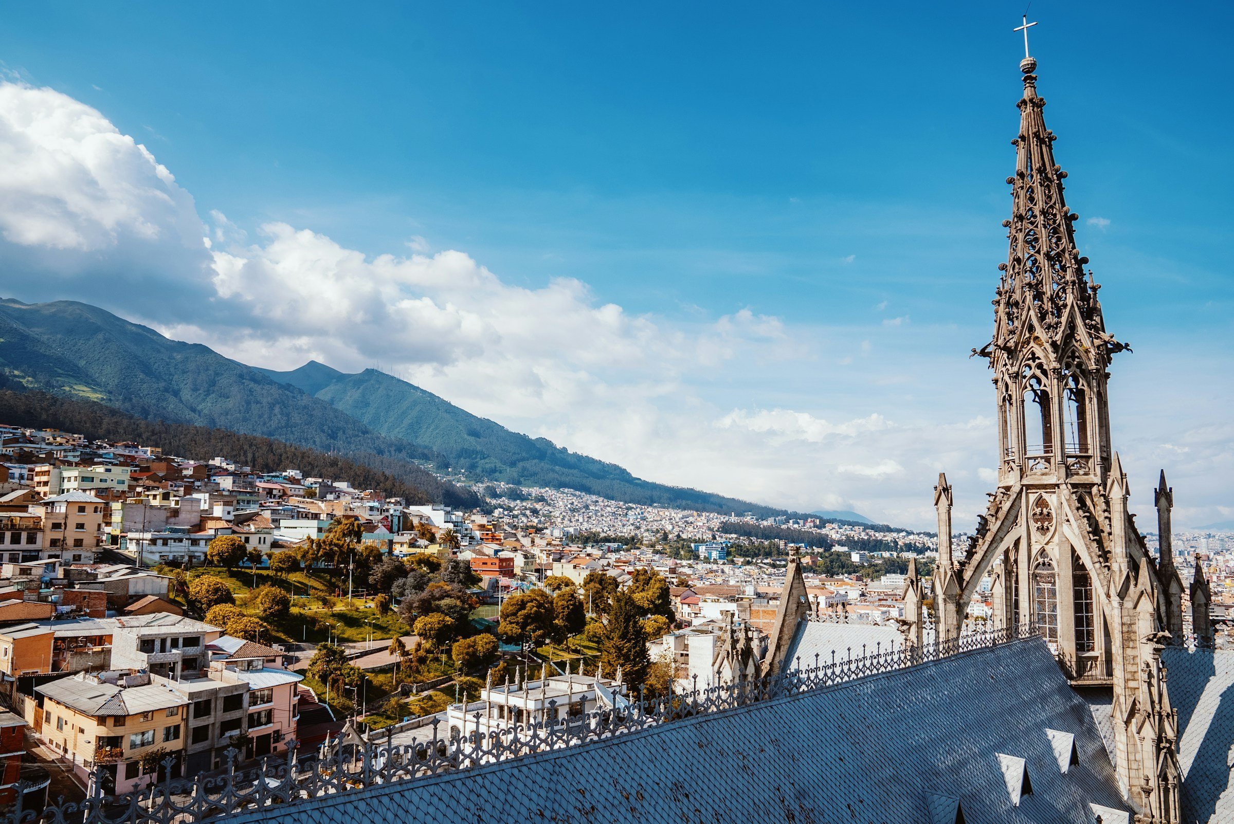
Centro Histórico at 2,850 Meters
You start where the Spanish started in 1534, on streets that climb and descend without warning because the volcanic plateau offers no flat ground. Plaza Grande sits at the exact center, surrounded by the Presidential Palace’s white colonnade and the Cathedral’s green domes. The altitude makes every staircase a negotiation. Your lungs work harder. Coffee tastes stronger at this elevation, and the vendors selling it from thermoses on Calle García Moreno know you’ll need a second cup.
The thing nobody tells you is that colonial architecture here doesn’t photograph the same way it does in Cartagena or Cusco. The light at this latitude, zero degrees and zero minutes, hits buildings without the golden-hour drama you get farther north or south. Midday sun is vertical. Shadows disappear under archways. The baroque facades of La Compañía de Jesús look almost flat until you’re close enough to see the gilded altar inside, where seven tons of gold leaf cover every surface in a darkness that took 160 years to complete.
San Francisco and the Geometry Problem
Walk west five blocks to where Plaza San Francisco opens up, the largest colonial square in South America. The monastery complex spreads across three hectares, its atrium designed to hold thousands for outdoor mass. Stand at the southern edge and you can see something strange: the city’s street grid doesn’t align with cardinal directions. The Spanish laid out Quito along the valley floor, which runs roughly north-south but twists as it follows the terrain. GPS coordinates here are more suggestion than certainty.
Inside the monastery, the Museo Fray Pedro Gocial displays Quito School paintings where Indigenous artists depicted biblical scenes with Andean faces and clothing. Look for the Last Supper painting with cuy (guinea pig) on the table instead of lamb. The museum charges $3.50 (USD equivalent), but the side chapel dedicated to the Virgin of Quito is free and contains the original sculpture that became Ecuador’s most reproduced religious image.
La Ronda After Four Visits
Head south through the backstreets toward Calle La Ronda, the oldest residential street in the city. Tourist guides will tell you it’s been “restored” and “revitalized,” which means the colonial houses now hold craft workshops and cafes instead of families who’ve lived there for generations. The street is narrow enough that you can touch both walls with outstretched arms. After four visits I started to notice which businesses actually serve locals: the places selling helado de paila (hand-paddled ice cream made in copper bowls) for $1.50 versus the ones charging $4 for the same thing with a English menu.
The geography matters here more than the architecture. La Ronda runs east-west along what was once a ravine, and when afternoon rain hits (which it does without seasonal pattern because you’re at the equator), water rushes downhill toward the street. Locals know which doorways stay dry.
El Panecillo’s Concrete Virgin

Quito
Climb south to the volcanic hill that marks the old city’s boundary. The Virgin of Quito statue on top is visible from everywhere in the valley, a 41-meter aluminum monument built in 1975 on Inca and pre-Inca ruins. She faces north toward the city, wings spread because this Virgin is based on a sculpture that combined Catholic and Indigenous symbolism in ways that made colonial authorities uncomfortable for two centuries.
The view explains why Quito exists in this exact spot. To the east, Volcán Cayambe rises above 5,790 meters, its peak perfectly on the equator with glaciers in both hemispheres. To the north, the city spreads up the valley for 50 kilometers. To the west, the ridge of Volcán Pichincha blocks any expansion in that direction. The city grew in the only direction geology allowed.
Taxis to El Panecillo cost $3 to $5. Walking up from La Ronda takes 40 minutes and the neighborhood between them has a reputation for theft targeting obvious tourists with visible cameras and new backpacks.
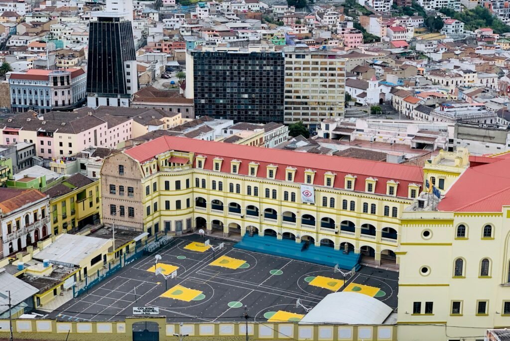
Mariscal’s Grid Versus the Valley
Return north past the historic center into Mariscal, where the street grid tries and fails to be rational. This neighborhood was planned in the 1930s with the assumption that the valley floor was flat. It isn’t. Avenida Amazonas runs ruler-straight until the terrain forces it to curve. Side streets that look parallel on maps meet at odd angles when builders encountered bedrock or slopes too steep for foundations.
The backpacker hostels here charge $12 to $18 per bed. The craft beer bars serve Pilsener (Ecuador’s industrial lager) for $2.50 and imported IPAs for $6. You’ll see more English on signs than Spanish after 7pm. The Parque El Ejido art market on weekends sells paintings of Andean landscapes that all look identical because they’re produced by the same workshop and signed with different names.
La Floresta’s Eucalyptus Angles
Walk east into La Floresta, where the valley starts its climb toward the Cumbayá Valley beyond the ridge. The neighborhood was built in the 1930s and 40s when eucalyptus trees were planted everywhere as a fast-growing solution for firewood. They’re still here, dropping bark and choking out native plants, but they make the streets smell like menthol after rain.
The thing that matters about La Floresta is the tilt. Streets that look level force you to lean forward. Your calves notice what your eyes don’t register. Cafes like Chez Tiff and El Cafecito installed outdoor seating that had to be shimmed level because the sidewalk grades differ by five degrees over three meters. The coffee is better here than in Mariscal, $2 for an espresso, because the owners aren’t depending on hostel guests for survival.
Mitad del Mundo’s Measurement Error
The official equator monument is 26 kilometers north of the city center. The French geodesic mission in 1736 calculated the position, and Ecuador built a monument there in 1979. GPS proved in the 1990s that they were 240 meters off. The actual equator runs through the Intiñan Museum next door, where guides demonstrate how water drains differently on each side of the line and how it’s easier to balance an egg on the equator because gravitational forces align.
Both claims are disputed by physics. The water trick works anywhere if you control the container shape. The egg balancing happens when the surface is textured enough, regardless of latitude. But you’re standing in both hemispheres with one foot in each, which is the only thing that matters about this location.
Buses from Ofelia station cost $0.40 and take 90 minutes. Tourist vans from Mariscal charge $15 round trip. The monument entrance is $5. The Intiñan Museum is another $4. Neither includes much beyond the photo opportunity and the knowledge that equatorial cities exist in a permanent present tense where seasons don’t mark time and the sun crosses directly overhead twice per year with no shadow at all.
If you liked this, you might like: La Paz, Guatemala City, Montevideo.
Planning the trip? compare flight deals from Stavanger, Oslo, Bergen, and Trondheim.